… As If People Mattered

A while ago, our group read this great piece which reflects on design and impact of buildings with and without the “benefit” of an architect: “Architecture As If People And The Planet Mattered”, by Taz Loomans. It “hit home” with all of us.

We examine the impacts that “lack of design” has on Round Lake Beach, in many layers including economic, infrastructure, social, etc. Given the sprawl-centric focus of the village’s Comprehensive Land Use Plan [.pdf], the term “Architect” seems to almost be a dirty word. Rather, thoughts of “real” architecture seem to be missing in any vision for our community.

As a reminder, RLB wasn’t intentionally “founded” as a village, in the traditional sense. It was never intended to BE a municipality, never had its “skeleton”, it’s framework, laid out in accordance with validated-through-the-centuries knowledge of how humans work and what they need… all that serious Village Elder stuff.

No, RLB is the result of a summer-home subdivision lacking electricity, water, and sanitary systems, which was pressed into year-round habitation during the Great Depression, voting to incorporate as a village to get the legal standing and “Ooomph!” it needed to finance and install the semblance of a municipal infrastructure.

Without a “plan” or even just a “vision” for the village, with no center, square, plaza, promenade, or anything resembling a “downtown” or market place, there was no call to design anything important, be it a space or a building (certainly nothing worthy of a historical standing). As a result, 75+years later, the many benefits of architectural design (of buildings) and civic design (of the village itself) are completely missing; they were never “planted”, so couldn’t “grow”.

When we grew, our use of design services was almost verbatim from Taz’s writing:

The process can often look like this: a developer hires an architect to build, say, a strip mall. The developer, not the end users, are the client of the architect. And unless the developer cares about the people that will ultimately use the strip mall in addition to her bottom line, than likely the design of the strip mall will be a combination of cost reduction strategies, code compliance and what in the past has been done with strip malls.

The experience of the end user and how the strip mall affects the community and the planet often have little or nothing to do with its design. This is how we’ve ended up with an endless sea of low-quality, automobile-centric and soul-numbing sameness that is our built environment.

Sound about right?

BTW, that little “buffer-strip” of land behind the Burger King and O’Reilly Auto Parts… that’s zoned for a strip mall. When you look at the last 15 years of “growth” here, other than “big-box” places like Home Depot and LA Fitness, almost everything else has been either a strip mall or an auto parts store,on a more-or-less alternating basis. Think about it: Sweetwater Crossing, Auto Zone, Hook Commons, Advance Auto Parts… here’s your next pair!

For Sale sign in front of O'Reilly Auto Parts in RLB

For Sale sign in front of O’Reilly Auto Parts in RLB

Wait a minute did we say “zoned” for a strip mall? Heck, it’s been laid out for one since at least 1997, the date on this print (click to enlarge):

Rollins Corner
In fact, the concrete curbing for much of it has already been installed. Check out these photos just north of the Burger King, then compare them to the diagram above!

Photo10201640Photo10201641Photo10201641_2Photo10201639

Posted in Design, Downtown, Planning | Leave a comment

Friday Funny — the Cycling Realtor

Might get a little more understanding about the state of bicycling conditions in our part of Lake County if our local realtors would hop on and hit the pavement once in a while!

We’ve seen Cycling Santa, the Cycling NPA Mayoral Hopeful — and now, the Cycling Realtor, for whom the wheels of commerce are two in number and powered by legs alone. Note TWO (count ’em, TWO) exclamation marks in the header. Found in the Georgia Straight, April 19, 2018.

via Friday Funny — the Cycling Realtor — Price Tags

Posted in Bicycling | Leave a comment

Always some Webinars out there!

Not being in the Urban Planning profession (at least, not YET), our group members tend not to attend regional and national-level meetings, conferences, trade-shows, etc., targeted at those who deal with aspects of “Placemaking” on a daily basis.

Click on this graphic to see this wonderful space & place evaluation tool full size...

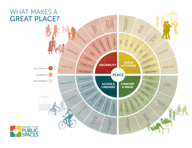
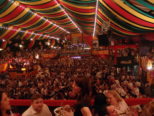
Click on this graphic to see this wonderful space evaluation tool full size…

Doesn’t mean we’re without resources though. For instance, we have our steadily growing library of awesome books (ebay is our friend!) covering a wide variety of related topics like planning, design, history, society, traffic, politics & administration, etc., and real world “how to” examples of fixing places even worse-off than Round Lake Beach.

Of course there are online forums and discussion groups. They help us reach outside the relative isolation of the extreme NW suburbs.

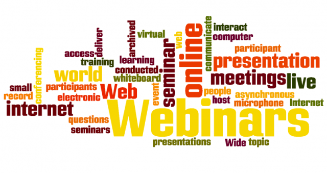
One of our favorite resources though has got to be the webinars. There are ALWAYS several relevant webinars per month. These allow us to “rub elbows” (albeit virtually) with  planners, designers, municipal officials and functionaries, representatives of organizations like the American Planning Association (APA) and Chicago Metropolitan Agency for Planning (CMAP), and community leaders from all across the country.

Webinar
We don’t report on most of ’em to you, but we try to make sure that at least one of us participates in the ones relevant to us if possible, and that if the sessions are recorded… we download them or get access to the archive for the organization(s) hosting them.

Here’s a look at some, past and present. As you look at the (not-at-ALL complete or comprehensive) list below, ASK YOURSELF: Based on what you hear from our village staff and officials through things like the village newsletter, village-wide events, press releases, and newspaper coverage, how many of these (usually free) resources do you think they access:

WEBINAR “The Best of Pro Walk Pro Bike Pro Place 2014”
– Vision Zero for Pedestrian Safety: New Thinking from San Francisco and New York
– Designing Intersections for Cycle Tracks: The Vancouver Experience
– Rethinking and Activating Public Space in Seattle and Boston
Date: February 25, 2015, 3:00 p.m. to 4:30 p.m. ET (Continuing education credits available)
Host: Association of Pedestrian and Bicycle Professionals & Project for Public Spaces
Details: http://bit.ly/1986vtq, free to APBP members, $85 for non-members (site license) The Best of Pro Walk Pro Bike Pro Place 2014

WEBINAR “Livability Principles at Highway Interchanges”
Date: February 26, 2015, 3:00 p.m. to 4:30 p.m. ET
Presenters: Steve Nieman (Planning Consultant), André Luboff (HNTB Corp.) Caryn Champine (City and County of Denver, CO) & Rodney Vaughn (FHWA)
Host: ContextSensitiveSolutions.org, FHWA, Project for Public Spaces & Sevatec
Details: http://bit.ly/1zV6GkI, free

WEBINAR “Creating Smart Paths for Connected Cities Webinar”
Date: February 26, 2015, 10:30 a.m. to 12:00 p.m. ET
Presenters: TBD
Host: U.S. Department of Transportation
Details: http://bit.ly/1uEcNe1, free

WEBINAR “Speed Management for Pedestrian and Bicycle Safety”
Date: February 26, 2015, 1:00 p.m. to 2:30 p.m. ET
Presenters: TBD
Host: FHWA
Details: http://1.usa.gov/1CgPvbw, free

WEBINAR “Driving in America: Emerging Trends and Policies”
Date: February 27, 2015, 3:30 p.m. to 4:30 p.m. ET
Presenters: Chris McCahill (State Smart Transportation Initiative), Norman Garrick (Univ. of CT) & Steven Cliff (Caltrans)
Host: State Smart Transportation Initiative
Details: http://bit.ly/1MQoiVw, free

SEMINAR (In person or live webcast) “Active Transportation Research at Northern Arizona University”
Date: February 27, 2015, 3:00 p.m. to 4:00 p.m. ET
Presenters: Edward J Smaglik (Northern Arizona University)
Host: TREC
Details: http://bit.ly/16B1Uyx, free

WEBINAR “Road Diets: Improving Safety for All Road Users”
Date: March 3, 2015, 1:00 p.m. to 2:30 p.m. ET
Presenters: Keith Knapp (Iowa Local Technical Assistance Program) & Brian Chandler (Leidos)
Host: PBIC
Details: http://bit.ly/1wcl4kO, free

WEBINAR “Building Equity: Race, Class and Protected Bike Lanes (Protected Lanes #1)”
Date: March 4, 2015, 3:00 p.m. to 4:00 p.m. ET (Continuing education credits available)
Presenters: Michael Anderson & Martha Roskowski (PeopleForBikes) & Chema Hernández Gil (San Francisco Bicycle Coalition)
Host: Association of Pedestrian and Bicycle Professionals & PeopleForBikes
Details: http://bit.ly/1zV7VQF, free

WEBINAR “Developing Effective Practices for Snow Removal: Why is it Worth all the Effort?”
Date: March 5, 2015, 2:00 p.m. to 3:30 p.m. ET
Presenters: Donna Smith & Kristi McLaughlin (Easter Seals Project Action Consulting) & Julie Dupree (Easter Seals Transportation Group)
Host: Mid-Atlantic ADA Center
Details: http://bit.ly/1BSDKwY, free

WEBINAR “Lessons from the Experts: 10 First Steps to Walkability”
Date: March 9, 2015, 1:00 p.m. to 2:00 p.m. ET
Presenters: Mark Fenton (Walkability Expert)
Host: America Walks
Details: http://bit.ly/1tYvYPG, free

WEBINAR “Australasian Pedestrian Facility Selection Tool webinar”
Date: March 9, 2015, 10:00 p.m. to 11:00 p.m. ET (Yes, p.m.)
Presenters: TBA
Host: Austroads (Australia)
Details: http://bit.ly/1vxENjY, free

WEBINAR “Bicycle Friendly Communities”
Date: March 17, 2015, 12:00 p.m. to 1:00 p.m. ET
Presenters: Justin Jones (Share the Road Cycling Coalition) & Bill Nesper (League of American Bicyclists)
Host: Tools of Change
Details: http://bit.ly/1wU8iWL, $70 (Limited number of free registrations available)

WEBINAR “Biking and Communities of Color: Friend or Foe?”
Date: March 18, 2015, 1:00 p.m. to 2:00 p.m. ET
Presenters: Lyna Truong (Asian and Pacific Islander Obesity Prevention Alliance), Adrian M. Lipscombe (Austin Transportation Dept.), Martha Roskowski (PeopleForBikes), Olatunji Oboi Reed (Slow Roll Chicago) & Keith Benjamin (Safe Routes to School National Partnership)
Host: Safe Routes to School National Partnership
Details: http://bit.ly/1GshU2u, free

WEBINAR “Pedestrian and Bicycle Counting Programs”
Date: March 18, 2015, 3:00 p.m. to 4:00 p.m. ET (.1 CEU, 1 AICP CM)
Presenters: TBA
Host: Association of Pedestrian and Bicycle Professionals (APBP)
Details: http://bit.ly/1s4X5HC, $50 APBP members/$85 non-APBP members, or multi-webinar discounts (Site Fee)

WEBINAR “Trail Wayfinding Systems: A Practical Guide to Principles, Best Practices, and Deployment”
Date: March 18, 2015, 1:00 p.m. to 2:30 p.m. ET
Presenters: Jenny Rigby (The Acorn Group), Karen Vitkay (Alta Planning + Design), Mark Vanderklipp & Jeff Frank (Corbin Design, Inc.) &Bob Searns (The Greenway Team)
Host: American Trails
Details: http://bit.ly/1Esjrq1, $35 members / $55 nonmembers (CEUs $20 additional fee)

WEBINAR “Legal Rights and Issues for Pedestrians and Cyclists”
Date: April 15, 2015, 3:00 p.m. to 4:00 p.m. ET (Continuing education credits available)
Presenters: TBA
Host: Association of Pedestrian and Bicycle Professionals (APBP)
Details: http://bit.ly/1DZJCSD, $50 APBP members/$85 non-APBP members, or multi-webinar discounts (Site Fee)

WEBINAR “Law Enforcement Strategies to Improve Pedestrian and Cyclist Safety”
Date: May 20, 2015, 3:00 p.m. to 4:00 p.m. ET (Continuing education credits available)
Presenters: TBA
Host: Association of Pedestrian and Bicycle Professionals (APBP)
Details: http://bit.ly/1Fr96bV, $50 APBP members/$85 non-APBP members, or multi-webinar discounts (Site Fee)

WEBINAR “Partners for Places Grant Webinar (See Jobs section for RFP)
Date: June 8, 2015, 1:00 pm – 2:00 pm ET
Presenters: TBA
Host: Funders’ Network for Smart
Details: http://bit.ly/1IcwLiN, free

WEBINAR “Using the Right Tools for Systemic Safety Analysis
Date: June 8, 2015, 1:00 pm – 3:00 pm ET
Presenters: Scott Davis (Thurston County, WA), Scott Jones (UT DOT) & Doug Bish (OR DOT)
Host: Federal Highway Administration
Details: http://1.usa.gov/1ePd1YQ, free

CONFERENCE CALL “Citizen Planning Academies
Date: June 11, 2015, 3:00 pm – 4:00 pm ET
Presenters: Wayne Senville (PlannersWeb.com), Leanna Lawson (Rockingham County Citizens’ Academy) & Kathleen Osher (Transit Alliance)
Host: Community Matters
Details: http://bit.ly/1SVP01W, free

WEBINAR “Why Walking?” (1st Walking College Webinar)
Date: June 18, 2015, 1:00 pm – 2:00 pm ET
Presenters: Jonathon Stalls (Walk2Connect) & Jim Stone (Circulate San Diego)
Host: America Walks, Centers for Disease Control and Prevention, American Public Health Association, New Jersey Department of Health, & Every Body Walk! Collaborative
Details: http://bit.ly/1SVrdiT

WEBINAR Pedestrian Safety Enforcement Operations” (see Resources section)
Date: June 18, 2015, 2:00 pm – 3:30 pm ET
Presenters: Wil Price (National Highway Traffic Safety Admin.), Ranjit Walia (Civic Eye Collaborative LLC), George Branyan (Washington DC DOT) & Sergeant Richard Ruth (Orlando Police Dept.)
Host: Pedestrian and Bicycle Information Center
Details: http://bit.ly/1eONf7j, free

WEBINAR “Taking Steps to Prevent Pedestrian Injuries: New Tools & Resources”
Date: June 18, 2015, 3:00 pm – 4:00 pm ET
Presenters: Scott Bricker (America Walks), Stefanie Seskin (National Complete Streets Coalition), James Gallagher (Pedestrian and Bicycle Information Center) & Katie Arseniadis (Safe States Alliance)
Host: Safe States Alliance
Details: http://bit.ly/1EV3Yuq, free

WEBINAR “Understanding the Socio-Psychological Factors Affecting Active Travel to School”
Date: June 23, 2015, 1:00 pm – 2:00 pm ET
Presenters: June 23, 2015, 1:00 pm – 2:00 pm ET
Host: National Institute for Transportation and Communities
Details: http://bit.ly/1Ftmmv9, free

WEBINAR “Designing Places for People” (2nd Walking College Webinar)
Date: June 23, 2015, 2:00 pm – 3:00 pm ET
Presenters: Dan Burden & Samantha Thomas (Blue Zones)
Host: America Walks, Centers for Disease Control and Prevention, American Public Health Association, New Jersey Department of Health, & Every Body Walk! Collaborative
Details: http://bit.ly/1FsRHOB, free

WEBINAR “Institutionalizing the Change” (3rd Walking College Webinar)
Date: July 15, 2015, 2:00 pm – 3:00 pm ET
Presenters: Mark Fenton
Host: America Walks, Centers for Disease Control and Prevention, American Public Health Association, New Jersey Department of Health, & Every Body Walk! Collaborative
Details: http://bit.ly/1FtISF9, free

WEBINAR “Transit-Oriented Development and Equity in Latino Neighborhoods: A Comparative Case Study of Macarthur Park (Los Angeles) and Fruitvale (Oakland)
Date: July 16, 2015, 1:00 pm – 2:00 pm ET
Presenters: Gerardo Sandoval (Univ. of OR)
Host: National Institute for Transportation and Communities
Details: http://bit.ly/1QpaNev, free

WEBINAR “How Rapid Transformation Delivers Bike-Friendly Urban Streets”
Date: July 29, 2015, 3:00 – 4:00 pm ET
Presenters: TBA
Host: Association of Pedestrian and Bicycle Professionals & the Green Lane Project.
Details: http://bit.ly/1Iq2URh, free

WEBINAR “Safe and Accessible Pedestrian Routes for Older Adults”
Date: July 30, 2015, 2:00 – 3:30 pm ET
Presenters: Isabel Rovira (Miami Urban Health Solutions/Urban Health Partnerships Program) & Ben Woody (Currituck County, NC)
Host: National Center on Senior Transportation
Details: http://bit.ly/1I90tn7, free

WEBINAR “Part I: Americans’ Views of Transportation and Livable Communities”
Date: August 5, 2015, 1:00 – 2:00 pm ET (1 CM credit) (Part 2 on August 11, 2015)
Presenters: Jennifer Dill (Portland State University) & Hugh Morris (National Association of Realtors)
Host: National Institute for Transportation and Communities
Details: http://bit.ly/1D7SKZZ, free

WEBINAR “Walkability: The Health and Wellness Equation W =WCA2”
Date: August 6, 2015, 2:00 – 3:00 pm ET
Presenters: Dan Burden & Samantha Thomas (Blue Zones)
Host: America Walks
Details: http://bit.ly/1H0MMVz, free

WEBINAR “Four Types of Cyclists: A National Look”
Date: August 11, 2015, 1:00 – 2:00 pm ET (1PDH, 1 CM pending)
Presenters: Jennifer Dill (Portland State Univ.)
Host: National Institute for Transportation and Communities
Details: http://bit.ly/1QpaNev, free

WEBINAR “Engage with Local Government: Critical Stakeholders in Your Walkable Community Movement”
Date: August 14, 2015, 2:00 – 3:00 pm ET (1 CM credit)
Presenters: Elaine Clegg (Boise City Council), Roger Millar (Smart Growth America) & Gary Toth (Project for Public Spaces)
Host: America Walks
Details: http://bit.ly/1IpST6K, free

Webinar “Surgeon General’s Call to Action on Walking and Walkable Communities: What Does It Mean for You and Your Organization?”
Date: September 15, 2015, 1:00-2:00 pm ET
Presenters: TBA
Host: America Walks
Details: http://bit.ly/1g8x6cI, free

Webinar “U.S. Federal Policy Briefing”
Date: September 15, 2015, 1:00 – 2:00 pm ET
Presenters: Caron Whitaker (League of American Bicyclists)
Host: Association of Pedestrian and Bicycle Professionals
Details: http://bit.ly/1h1SZvN, free

Webinar “Livability and the Connection Between Housing and Transportation”
Date: September 16, 2015, 2:00 – 3:00 pm ET
Presenters: David Kack (Western Transportation Institute)
Host: UNK
Details: http://bit.ly/1K1b8GD, free

Webinar or Seminar “Beyond Traffic 2045: Reimagining Transportation Series: The Second Machine Age: Work, Progress, and Prosperity in a Time of Brilliant Transportation”
Date: September 18, 2015, 12:00 – 1:00 pm ET
Presenters: Anthony Foxx & Gregory D. Winfree (US DOT) &Andrew McAfee (Massachusetts Institute of Technology)
Host: Volpe, The National Transportation Systems Center, Cambridge, MA
Details: http://1.usa.gov/1Ocjnj5, free

Webinar “Ten years of Safe Routes to School Celebrating Successes and Looking Toward the Future”
Date: September 23, 2015, 2:00 – 3:00 pm ET
Presenters: Wesley Blount (Federal Highway Administration), Seth LaJeunesse (National Center for Safe Routes to School), Rachele Solomon (Univ. of Miami), David Henderson (Miami-Dade Metropolitan Planning Organization), Vivian G. Villaamil (Miami-Dade County Public Schools), et al.
Host: National Center for Safe Routes to School
Details: http://bit.ly/1Ocis25, free

Webinar “Update on E-bike Legislation”
Date: October 8, 2015, 1:30 pm – 2:30 pm ET
Presenters: Alex Logemann (Bicycle Product Suppliers Association/PeopleForBikes), Morgan Lommele (PeopleForBikes) & Dave Snyder (California Bicycle Coalition)
Host: Alliance for Biking & Walking, PeopleForBikes
Details: http://bit.ly/1QYBuIe, free

Webinar “Making Physical Activity a Vital Sign” (part of Prescription to Move series, #Rx2Move)
Date: October 13, 2015, 3:30 pm – 4:30 pm ET
Presenters: Rosemary Agostini (Group Health Cooperative), Robert Sallis, (Kaiser Permanente) & Richard Troiano (US National Cancer Institute)
Host: Kaiser Permanente
Details: http://bit.ly/1RtkGK8, free

[See Resource section for “A Prescription to Move (#Rx2Move) – How Health Care Providers Can Encourage Physical Activity for Patients and Communities”]

Webinar “Step it Up!: Connecting the Dots- First Steps in Working with Regional Offices”
Date: October 15, 2015, 3:00 pm – 4:00 pm ET
Presenters: Representatives from regional offices of federal agencies
Host: America Walks
Details: http://bit.ly/1MdLnOx, free

Webinar “Marked Crosswalks” (Countermeasure Strategies for Pedestrian Safety series)
Date: October 15, 2015, 1:00 pm – 2:30 pm ET (1.5 APA CM credits pending)
Presenters: Peter Eun (FHWA Resource Center) & Charlie Zegeer (UNC Highway Safety Research Center)
Host: Pedestrian and Bicycle Information Center
Details: http://bit.ly/1JRkQVA, free

Webinar “Pedestrian and Bicycle Safety on University Campuses”
Date: October 16, 2015, 1:00 pm – 2:30 pm ET
Presenters: Bob Schneider (Univ. of WI-Milwaukee), Todd Henry (Univ. of CA, Berkeley) & Kathryn Zeringue (NC State University)
Host: Pedestrian and Bicycle Information Center
Details: http://bit.ly/1KZ7hXT, free

WEBINAR “Tactical Urbanism”
Date: October 21, 2015, 3:00 – 4:00 pm ET (1 CM credit)
Presenters: TBA
Host: Association of Pedestrian and Bicycle Professionals
Details: http://bit.ly/1ecB8jw, $50 APBP members, $85 non-members

Webinar “Curb Extensions, Bulb-Outs and Neckdowns” (Countermeasure Strategies for Pedestrian Safety series)
Date: October 27, 2015, 1:00 pm – 2:30 pm ET (1.5 APA CM credits pending)
Presenters: Peter Rusch (formerly WI DOT & FHWA)
Host: Pedestrian and Bicycle Information Center
Details: http://bit.ly/1LxsgVl, free

Webinar “Sustainability as an Organizing Principle for Transportation Agencies”
Date: October 27, 2015, 1:00 pm – 2:30 pm ET
Presenters: Gary McVoy (McVoy Associates, LLC) &Tori Adams (Booz Allen Hamilton)
Host: Transportation Research Board
Details: http://bit.ly/1VA4894, free for TRB affiliates, $89 for others

Webinar “Rectangular Rapid Flashing Beacons” (Countermeasure Strategies for Pedestrian Safety series)
Date: November 5, 2015, 1:00 pm – 2:30 pm ET (1.5 APA CM credits pending)
Presenters: Michael Cynecki (Lee Engineering)
Host: Pedestrian and Bicycle Information Center
Details: http://bit.ly/1OkCadb, free

Webinar “Pedestrian Hybrid Beacons” (Countermeasure Strategies for Pedestrian Safety series)
Date: November 12, 2015, 2:00 pm – 3:30 pm ET (1.5 APA CM credits pending)
Presenters: Richard Nassi (Pima Assoc. of Governments)
Host: Pedestrian and Bicycle Information Center
Details: http://bit.ly/1OkCsRz, free

Webinar “Leading Pedestrian Interval” (Countermeasure Strategies for Pedestrian Safety series)
Date: December 2, 2015, 1:00 pm – 2:30 pm ET (1.5 APA CM credits pending)
Presenters: Margaret Kubilins (VHB)
Host: Pedestrian and Bicycle Information Center
Details: http://bit.ly/1Okei85, free

Webinar “Future Directions for Multimodal Research and Practice”
Date: December 9, 2015, 2:00 pm – 3:30 pm ET
Presenters: Kristine Williams (Univ. of South Florida), Darby Watson (Seattle DOT), John Gordon (Metro) & Tiffany Chu (Remix)
Host: Transportation Research Board
Details: http://bit.ly/1Nmpe6s, free for TRB affiliates, $49 for others

Webinar “Pedestrian Safety at Interchanges” (Countermeasure Strategies for Pedestrian Safety series)
Date: December 10, 2015, 4:00 pm – 5:30 pm ET (1.5 APA CM credits pending)
Presenters: Meghan Mitman (Fehr and Peers)
Host: Pedestrian and Bicycle Information Center
Details: http://bit.ly/1Q6KMle, free

Webinar “Lighting Strategies for Pedestrian Safety” (Countermeasure Strategies for Pedestrian Safety series)
Date: December 15, 2015, 1:00 pm – 2:30 pm ET (1.5 APA CM credits pending)
Presenters: Michael Cynecki (Lee Engineering)
Host: Pedestrian and Bicycle Information Center
Details: http://bit.ly/1FSPJOz, free

Webinar “Traffic Calming” (Countermeasure Strategies for Pedestrian Safety series)
Date: December 17, 2015, 1:00 pm – 2:30 pm ET (1.5 APA CM credits pending)
Presenters: Peter Lagerwey (Toole Design Group)
Host: Pedestrian and Bicycle Information Center
Details: http://bit.ly/1jNpQp3, free

Webinar “Designing and Conducting Research on Policy Implementation”
Date: December 17, 2015, 1:00 – 2:00 pm ET
Presenters: Paul Estabrooks (VA Tech) & Keshia Pollack (Johns Hopkins)
Host: Active Living Research
Details: http://bit.ly/1JbDjgB, free

Webinar “Hear from the States: Multimodal Development and Delivery”
Date: December 17, 2015, 2:00 – 3:00 pm ET
Presenters: Kevin Marshia (VT Agency for Transportation, Roger Millar (WA DOT), Billy Hattaway (FL DOT) & Beth Osborne (Smart Growth America)
Host: State Smart Transportation Initiative
Details: http://bit.ly/1lOvp8a, free

Webinar “Roundabouts” (Countermeasure Strategies for Pedestrian Safety series)
Date: January 6, 2016, 1:00 pm – 2:30 pm ET (1.5 APA CM credits pending)
Presenters: Hillary Isebrands (FHWA Resource Center)
Host: Pedestrian and Bicycle Information Center
Details: http://bit.ly/1LibUJV, free

Webinar “Update on State Bicycling Legislation”
Date: January 14, 2016, 2:00 – 3:00 pm ET
Presenters: Alex Logemann (PeopleForBikes)
Host: Alliance for Biking and Walking & PeopleForBikes
Details: http://bit.ly/1TPvD9p, free

Webinar “Livable Communities for all Ages” America Walks Webinar Series
Date: January 14, 2016, 2:00 – 3:00 pm ET
Presenters: Jeanne Anthony (AARP)
Host: America Walks & AARP
Details: http://bit.ly/1T1pCX9, free

Webinar “Pedestrian Safety and Transit ” (Countermeasure Strategies for Pedestrian Safety series)
Date: January 20, 2016, 1:00 pm – 2:30 pm ET (1.5 APA CM credits pending)
Presenters: Dan Nabors (VHB)
Host: Pedestrian and Bicycle Information Center
Details: http://bit.ly/1FWgS2C, free

Webinar “Understanding Transportation Safety Risks on Tribal Lands: Learning from a Collaborative Research Project with American Indian Communities in Minnesota”
Date: February 4, 2016, 2:00 – 3:30 pm ET
Presenters: Guillermo Narvaez & Kathryn Quick (Univ. of MN)
Host: Transportation Research Board
Details: http://bit.ly/1QLkYgO, free

Webinar “Pedestrian Planning for Communities: A Transferable Training Program from Kentucky” America Walks Webinar Series
Date: February 11, 2016, 2:00 – 3:00 pm ET
Presenters: TBA
Host: America Walks
Details: http://bit.ly/1RogDBC, free

Webinar “Exploring Tactical Urbanism” America Walks Webinar Series
Date: March 10, 2016, 2:00 – 3:00 pm ET
Presenters: TBA
Host: America Walks
Details: http://bit.ly/1TPEisy, free

Webinar “Surgeon General’s Call to Action – Walking as a Practice” America Walks Webinar Series
Date: April 14, 2016, 2:00 – 3:00 pm ET
Presenters: TBA
Host: America Walks
Details: http://bit.ly/1QpDihc, free

Webinar “Surgeon General’s Call to Action on the Ground” America Walks Webinar Series
Date: May 12, 2016, 2:00 – 3:00 pm ET
Presenters: TBA
Host: America Walks
Details: http://bit.ly/1NwXnfd, free

Webinar “Surgeon General’s Call to Action – What’s Next?” America Walks Webinar Series
Date: June 9, 2016, 2:00 – 3:00 pm ET
Presenters: TBA
Host: America Walks
Details: http://bit.ly/1NwXpDZ, free

Webinar “Friends and Allies for the Walking Movement” America Walks Webinar Series
Date: July 14, 2016, 2:00 – 3:00 pm ET
Presenters: TBA
Host: America Walks
Details: http://bit.ly/1NwY0pa, free

Webinar “The First and Last Mile: Partnering with Public Transportation” America Walks Webinar Series
Date: September 8, 2016, 2:00 – 3:00 pm ET
Presenters: TBA
Host: America Walks
Details: http://bit.ly/1mnHBfZ, free

Webinar “A Movement of Individuals: Tools for the Advocate” America Walks Webinar Series
Date: October 13, 2016, 2:00 – 3:00 pm ET
Presenters: TBA
Host: America Walks
Details: http://bit.ly/1RohGBx, free

Webinar “Creating Vibrant Communities with the Community in Mind: Development and Gentrification” America Walks Webinar Series
Date: November 10, 2016, 2:00 – 3:00 pm ET
Presenters: TBA
Host: America Walks
Details: http://bit.ly/1P7JoB8, free

Webinar Word Cloud

Posted in Meeting / Webinar | Leave a comment

Another skinny example

The subdivided retail unit next to the Round Lake Beach Kohl’s is STILL vacant. (We’ve been coming up with examples of other, successful businesses and activities which could make use of the space, but no takers so far.

As shown in our original post about this spot, here’s a look at the interior of the unit as it has sat for these many, many months. Okay, years.

Vacant Unit

The Foundation Tiki Bar in Milwaukee WI

The Foundation Tiki Bar in Milwaukee WI

The bottom picture shows the interior of the Foundation Tiki Bar in Milwaukee WI.

Maybe a “Tiki Bar” isn’t exactly what we need in Round Lake Beach, but it sure makes good use of the same size and shape of space.

Posted in Business, Design, Downtown, Economics | Leave a comment

Yay! Another Strip Mall!

Well, it was time for more “growth”, so they broke out the ol’ “What Should We Build Next?” Wheel.  When the “Build a Downtown” option fell off decades ago, it was replaced with “Spin Again”. They since have gotten so used to all the options starting with “Build a stand-alone…” that none of them realized they could do anything else!

So they gave the wheel a mighty spin, and though it almost stopped on “Fast Food Franchise” and looked like it might continue on to “Oil Change/Muffler Shop/Auto Parts”… it passed “Drive-Thru Bank” and ultimately came to rest on “Strip Mall”.

Here’s where it’s going to be built, at the NW corner of Rt. 83 and Engle, north of the Walmart. You can see the vacant lot behind the sign:

Looking north from the Walmart parking lot, next to Rt. 83

Here’s a closer look, taken from the driveway at that intersection:

Looking west from Rt. 83 & Engle Drive.

Looking west from Rt. 83 & Engle Drive.

You might have noticed this sign lately, showing there was at least some campaigning by the owner to get activity with this lot:

McVickers Development is an outfit in Buffalo Grove, specializing in “Big Box” and stand-alone retail projects. To help find investors and businesses looking for suitable properties, McVickers has a webpage for each site available.

Their Walmart Outlot – Round Lake Beach page mentions the following:
https://www.mcvickers.com/properties/8-walmart-outlot-round-lake-beach

In 2006, McVickers purchased five vacant residential lots totaling one acre at the main signalized entrance to the newly constructed Walmart Supercenter (with groceries). McVickers’ lot is the only outlot in front of the Walmart. McVickers negotiated access rights as well as use of Walmart’s utility lines and offsite detention facility.

McVickers annexed and re-zoned the property with the Village of Round Lake Beach. The property is zoned for a bank with drive-thru, or a retail building with drive-thru.

There’s that ZONING thing getting in the way again! Anyway…

Up recently is this sign, right at the intersection:

Don’t know yet if HSA Commercial Real Estate will be the new owners, or just the “Property Managers”. It’s part of what they do all across the Midwest.

HSA put together a 2-page “Spec Sheet”, showing additional detail like area demographics, additional drawings, etc. Click HERE to open and view in a separate window if interested.

Here are a couple of graphics from the McVickers page about the property so you get a sense of what to expect:

Proposed site w/zoom. Click on the photo to open a .pdf of this graphic.

Proposed site w/zoom. Click on the photo to open a .pdf of this graphic.

Click on the photo to open a .pdf of this graphic.

Click on the photo to open a .pdf of this graphic.

Final details can vary, but this looks like a very typical multi-unit commercial strip building, about 100’x70′ based on initial drawings. None of the drawings so far depict positioning of an allowed drive-thru establishment, which is an important consideration on such a small lot.

Our initial thoughts and observations (aside from “Great… another strip mall.”):

  • Not seeing any sidewalk along the right-of-way by Rt. 83. Doesn’t mean it can’t happen, but since they didn’t include one in the drawings as a matter of practice, it also implies that in order to get one we’re going to have to require one. A sidewalk there is important for a variety of reasons, including of course access for the residents in that cluster of homes we’ve always considered to be “Venetian Village – West”. (It may have another name…) Note there is currently no sidewalk on the east side of Rt 83 either. While sidewalks are not intended to replace a (currently missing) N/S trail system connecting RLB and Lake Villa, it’s also never easier or cheaper to design and install one than during initial construction.
Will we make use of this opportunity to improve safety and connectivity for residents around the Walmart?

Will we make use of this opportunity to improve safety and connectivity for residents around the Walmart?

  • There’s an 8′ fence spec’d for the west and north sides of the property. Very typical in such construction for clear lines of demarcation, ownership, responsibilities, etc., yet it repeats a problem we have in so many other parts of the village. It turns the back of the businesses to many of the customers they’re trying to serve, and sets up a wall of “THOU SHALT NOT PASS”! True, new businesses, but no way for the people living closest to them to get there. Where’s the connectivity?
  • The vehicle entrance from Rt 83 is a “Right-in, Right-out” (Ri-Ro) type. Our concern is in the placement off the right southbound lane. Without a dedicated right-turn lane into the Walmart driveway at Engel, the right lane would serve simultaneously as a Rt. 83 thru lane and access for vehicles suddenly slowing to turn in to the new strip mall  and vehicles turning right into Walmart and vehicles using that Ri-Ro to enter southbound Rt 83 and vehicles passing on the right (’cause the idiot drivers are in a rush). That is a LOT of different types of use, with vehicles typically blitzing thru at a fast clip… even those intending to turn. We can’t imagine good things happening, or opportunity for drivers to make much eye contact to communicate intentions. Even WITH turn signals, are you turning into the strip mall, or planning to overshoot the driveway and turn at the Walmart? Did you just forget to turn on/off your signal, are you shooting for Monaville Road? Maybe you’re signaling a turn but your blinker has been on for the last 2 miles?
  • Where’s the snow going to go when the snowplows clear the parking spaces? Remember, most “snow removal” plans are really only “snow moving” plans.
  • We’ve already put our money down on this bet: No Bike Rack. By design, and with full village approval. Surprise us, we dare you!
  • If any of the new businesses is an eatery, they automatically, by design, have no place outside for al-fresco or bistro-style seating/dining. Strip malls are not designed for flexibility, for presenting options, esp. outdoors. Not even a nice place to sit in the shade and wait for your dinner companions. Those of us waiting for a “nice place to eat” in the village shall continue to wait.
  • Back to “connectivity” for a moment. Based on a quick house-count, there are probably about 200 residents living in the homes directly north of Walmart. As decreed by ordinance, there’s a 6′ wall of “Thou Shalt Not Pass” preventing them from simply walking the block or two it would take to do their grocery shopping there:
Easy walk from your home to the grocery store next door? Zoning say

Easy walk from your home to the grocery store next door? Zoning say “Not today”!

Here’s what we’ve got on the other side. The freakin’ street leads RIGHT TO THE FENCE!

Just a quick peek over the fence.

Just a quick peek over the fence.

So here’s a suggestion re: connectivity (’cause there ain’t none here)…

Put in a pedestrian/bicycle access. The neighborhood retains its overall quiet and safe atmosphere, with no “thru-traffic” of vehicles, yet allows convenient access to the store next door.

Why WOULDN’T you want connection? Kids can do more chores, those on a budget can avoid unnecessary car trips, land-locked seniors have more places walkably-close, etc.

Here’s the “Before Walmart” overview of the area. You can see multiple connections leading to the parcel from the north, east, and south… all goober’d-up by the big-box.

Play

Play “Connect the Streets” in your mind’s eye. You can see all the community connection that now CAN’T happen.

Glad to see that professionals out there think enough of RLB and its future to invest in us, but rather sad that it gives us more of the same physical format we have so much of already.

Strip malls are conducive to certain types of business, of which we already have a generous helping in the village. What we need are type of businesses we DON’T have yet, invited to (and by) different types of places and space, places which don’t exist here yet… and seem destined never to exist under the current administration.

What kind of places? (Click on each thumbnail to biggify…)

example2   Barracks_Row-DC   

Anyway, that’s our overly-dramatic first “take” on this news. As they say on the commercials, “Your mileage may vary”!

P.S. That “Yay!” in the title? We’re kidding…

Posted in Bicycling, Business, Design, Downtown, Planning, Walkability | 1 Comment

Orchard Lane – Opportunity

If you don’t have time to read this entire post, we’re making a pitch for the newly-resurfaced pavement on Orchard Lane to receive markings designating pedestrian crosswalks ACROSS (East/West) it, as well as using the opportunity to stripe a Bicycle Lane (even if only temporarily as a learning measure).

Why? #1: Orchard Lane is poorly designed, serving as a traffic collector and “aggregator”, gathering vehicles from the smaller side lanes (should be “streets”) and funneling them all towards one of only a few exit points. Not only that, it serves as a high-speed North/South shortcut, especially when there are delays due to train crossings or construction.

Why? #2: In July 2010, Illinois Governor Pat Quinn signed a state law requiring vehicles to make a full stop if a pedestrian is waiting to cross, or if he is in the process of crossing, at a non-controlled (no traffic lights) crosswalk. Five years later, most drivers are still unaware of this law. Of those that are, many believe it applies only at visibly-marked-on-the-pavement crosswalks, whereas the law applies to ALL crosswalks… whether marked or not.


For most of its fairly short life, Orchard Lane (in the Country Walk subdivision) has been unadorned by such trivialities as pavement markings and stripes. Here’s a representative photo:

This photo clearly shows intersections and sidewalks all around, yet not a single crosswalk (and even a missing STOP line). Orchard Park (off the picture to the top) is a common destination for pedestrians, joggers, bicyclists, dog-walkers, etc. Many need to cross the Orchard Lane Speedway, but have no clear place to do where (and this is the important part) drivers are EXPECTING them to cross.

This photo clearly shows intersections and sidewalks all around, yet not a single crosswalk (and even a missing STOP line). Orchard Park (off the picture to the top) is a common destination for pedestrians, joggers, bicyclists, dog-walkers, etc. Many need to cross the Orchard Lane Speedway, but have no clear place to do where (and this is the important part) drivers are EXPECTING them to cross.

Orchard Lane, from Monaville Road south for most of a mile, has been freshly resurfaced. Other than some N/S crosswalks and “Stop” lines, there are no other pavement markings on it as of this morning (Fri Oct 9th).

Newly-resurfaced Orchard Lane.

Newly-resurfaced Orchard Lane.

Most of the North/South crosswalks have been unmarked for… well. forever! Don’t know what took them so long, but they are a welcome addition.

We've waited a LONG time to get marked crosswalks along Orchard Lane. Still don't have them ACROSS Orchard though...

We’ve waited a LONG time to get marked crosswalks along Orchard Lane. Still don’t have them ACROSS Orchard though…

Of course, with the pavement unmarked and much wider than it needs to be in the middle of a 100% residential area, no parked cars or bike lanes to deal with (not even marked pedestrian crosswalks), sidewalks set WAY back from the pavement,fairly gentle curves… the built environment, the “context” of the pavement, screams “Here’s a place you are expected to drive fast.” So they do.

Instead of fixing that, the “Band-Aid” fix for that, for years, has been the road-side “Radar Reminder”.

Apparently having a couple of people with a camera, standing a radar speed display, had drivers worried that we were making our own

Apparently having a couple of people with a camera, standing at a radar speed display, had drivers worried that we were making our own “Photo speed trap”, ready to take time-stamped pictures of speed, cars, and license plates. Couldn’t get a picture of anyone exceeding 25 MPH.

Do you know where the ONLY E/W crosswalk across Orchard Lane is located? ALL the way from Monaville Road down to Rollins Road, there’s only one: at the intersection by Rollins Road between the Thornton’s and Wendy’s. That doesn’t help people trying to cross in the middle of the subdivision!

The only crosswalk for the entire length of Orchard Lane is here at Rollins Road.

The only crosswalk for the entire length of Orchard Lane is here at Rollins Road.

From the Chicago Tribune article “Crosswalk Study: Cars Don’t Stop for Pedestrians

Most drivers tracked in a new Chicago-area survey failed to comply with a state law requiring them to stop for pedestrians, a finding that the research’s backers attribute to inadequate police enforcement and education on traffic-safety laws. But the results suggest that driver compliance with the must-stop law may be significantly improved if more visual warning cues are placed at crosswalks.

But compliance with the statewide law requiring drivers to stop whenever a pedestrian has entered a crosswalk was only about 18 percent on average when the pedestrians attempted to cross a street in a traditional painted crosswalk, the survey found. And the compliance rate plummeted to almost 5 percent at unmarked crosswalks. Under the law, a crosswalk is present whenever a sidewalk leads into the street, regardless of any markings present.

Unmarked crosswalks, in the middle of a speedway dividing halves of a 100% residential area when drivers are not even aware of the law? Not a good idea. We should have had crosswalks marked, signed , and maintained for years now.

From this article by NBC5 Chicago: “Despite Law, Motorists Still Confused About Crosswalk Rules”

In front of Highland Park’s city hall, pedestrians and drivers alike routinely feel as if they’re in an odd dance for survival. And along 31st street in suburban Oak Brook, a deer-crossing sign immediately precedes a bike-crossing sign, but nothing indicating to drivers that they need to stop at the crosswalk itself.

“There has to be a clearer way for motorists to know that a pedestrian is attempting to cross the street instead of just standing at the curb,” said Oak Brook Police Chief Jim Kruger.

Make sure you watch the video from their Investigative Report!

Some municipalities actually bother to make it clearer for both pedestrians AND drivers as to where crosswalks are located AND the requirement to stop, using additional signage. Round Lake Park, as part of their recent downtown renovation, added these signs at their crosswalks:

An enhanced marked crosswalk in downtown Round Lake Heights, helping to make sure that everyone knows a full stop is required when the crosswalk is in use.

An enhanced marked crosswalk in downtown Round Lake Heights, helping to make sure that everyone knows a full stop is required when the crosswalk is in use.

OK… that point is just about beaten into submission. We’ll make a quick mention about bike lanes.

Once you’re in the Country Walk subdivision, Orchard Lane is more than wide enough to an on-street bike lane. What a great opportunity for the Mayor Hill, the Trustees, and RLB Public Works to inexpensively gather some data points by establishing a temporary bike lane on one side.

Yes, there are sidewalks on either side, but the general rule is for bicyclists to NOT ride on sidewalks unless there is no other choice. There’s an age cut-off which varies by municipalities, anywhere from 8-12 years is typical, so toddlers and small children still learning to ride may use the sidewalk for safety but teens and adults have to use “other infrastructure”.

Yes, there IS a multi-use trail along Hook Lake, but it is at the extreme eastern edge of the developments, and doesn’t serve the bulk of residents cycling N/S to Eagle Creek, Rollins Road, Walmart, Rollins Crossing, etc.

You can see in this image from Google Maps highlighting RLB Bicycle options… our few paths are a bit… disconnected… and connection is what we’re trying to get!

Solid green indicates established and marked bicycle paths/trails.

Solid green indicates established and marked bicycle paths/trails.

A N/S bike lane along Orchard leading up to Monaville Road would make a great connector from the west end of the bike lane along Hook Drive, and would GREATLY facilitate travel and recreation opportunities for residents in the Country Walk subdivision to-and-from our “Central Business District” and further if desired onto the Millennium Trail.

Wouldn't bee too hard to lay a stripe up one side of Orchard Lane...

Wouldn’t bee too hard to lay a stripe up one side of Orchard Lane…

Lastly, spend 5 minutes watching this video about a pop-up bike lane project:

Two Days in September from Julie Campoli on Vimeo.

Thanks! Let’s see what happens!

Posted in Uncategorized | Leave a comment

A look at LZ’s “Rock The Block”

While we don’t have to “copy” other villages and towns for ideas of what to do in our own, it is prudent to see what works (and what doesn’t) for our neighbors AND find out the “why” and “how” in each case.

For instance, the Village of Lake Zurich will host its 3rd annual downtown block party, Lake Zurich Rock The Block, on Saturday Sept 12, 2015 from 5pm – Midnight.

Logo Rock The BlockBetween a Chicago Tribune​ article and the event’s page on the Village of Crystal Lake website, we learn:

– The event will be held on Main Street: Streets are where the “life” of a municipality happens. We really need to look at how to handle future development in RLB to provide for multi-use(r) streets (’cause we ain’t got none!)

Some of what we need...

Some of what we need…

– The event will be held in downtown Lake Zurich: See the previous comment!

Blocking-off the street for the residents... and all is well!

Blocking-off the street for the residents… and all is well!

– To accommodate the event, Main Street will be closed: “What? Closing a major thoroughfare?” Yup, in places that “get it”, people are not only planned-for in the human-scale downtown and streetscape, sometimes they get priority use of the space. With our poor interconnectivity, we don’t dare block-off a road around here!

– This event is the Village of Lake Zurich’s second effort to sponsor a large scale downtown event, and planning for this event has been a “community effort”: COMMUNITY effort! When residents are seen by Village Hall as “co-owners” and not just taxpayers, then partnerships and division of labor among more people are much more likely to occur. OTOH, a Village Board working “solo” with limited experience and resources can quickly come to the point of “This is too much for us, let’s drop the idea”.  [See: “Farmers Market”]

– The Rock The Block task force is headed by the Village “Innovation Director” Michael Duebner. “THEY HAVE AN INNOVATION DIRECTOR?!?!”

– The village is set to dance the night away with the community from 5 p.m. to midnight Saturday: After-dark events provide their own kind of energy, and we don’t do NEARLY enough of them.

... and who DOESN'T love Food trucks?

… and who DOESN’T love ’em?

Eleven food trucks will be on site along with four local restaurants selling items including desserts and snacks: Food trucks help make “Instant Place”! A greater variety of food offerings draw more people. Local eateries still draw their loyal customers, and residents get a taste of something new, often to the point of helping get food trucks back for regular visits!

– Multi-tasking…The event highlights the need for more donations to restock the local community food pantry. Rock the Block also brings together the community to help them rediscover the appeal of downtown restaurants and boutiques: The Village applies time, effort, and resources to HELP the local business community beyond just throwing an application for a business license their way. It also shows the spirit of “greater good” in helping provide for those who are temporarily in need.

– A beer tent will also be set up, and it will sell wine and Mike’s Hard Lemonade products, four types of beer and local craft beer: Full of alcohol,  wandering the streets of downtownand no rioting? Don’t be so scared of adult beverages at events, Trustees.

OK... so maybe their Beer Tent won't be QUITE this large!

OK… so maybe their Beer Tent won’t be QUITE this large!

… and their closing statement:

“The unique part about Rock the Block is you’re supporting the local food pantry with an adult beverage in your hand while conversing with your friends and neighbors and enjoying a midsummer late evening.

It’s an event that’s really designed for the community to come together and rediscover the downtown.”

Yep, we could probably learn a useful concept or two by observing how our neighbors do things…

Posted in Community, Design, Downtown, Planning | Leave a comment

Webinar – Walkability: The Health and Wellness Equation

Webinar – Walkability: The Health and Wellness Equation
Date and Time: Wednesday Aug 6th, 2015 at 1pm Central Time
Cost: FREE (Advanced online registration required)

Logo AmericaWalks

Learn the strategies and steps that are making towns, of all sizes, healthy and accessible to everyone again.

In this session sponsored by AmericaWalks, Dan Burden, one of the early pioneers in North America’s walkability movement–coining the terms ‘Road Diets,’ ‘Walkability Audit,’ before-and-after ‘photomorphs’ and inspiring Complete Streets conversions–will address the link and bond between walking and health.

Walking is much more than basic transportation and recreation; it is the key to health, longevity and affordable living. If we want more equitable communities, more accessible communities, then walking must become a safe, natural activity again.

Ocean Grove Main Ave

The steps towards more walkable, healthy, livable communities will validate many of your own thoughts; after all, they are based on common sense, patterns, and science, all which have lead to best practices and strategies that produce real [positive] results.

Whatever level of engagement, if you are one of the pioneers or new to this craft, you will find benefit in this presentation and exchange.

Free online registration: HERE
Archive of Previous Webinars HERE

Additional links of interest:

Home


http://communitybuilders.net/walkability/
https://www.walkscore.com

Posted in Health, Meeting / Webinar, Walkability | Leave a comment

Vacant is as Vacant does

RLB Former Fashion Bug site

The former Fashion Bug store location in Round Lake Beach. Sally Beauty Supply moved into the center section; the vacant unit we’re talking about in this post is pictured to the far-right.

Decided to check for signs of life at the vacant retail unit next to Sally Beauty Supplies while getting some greeting cards at Ann’s Hallmark (same building as the Kohl’s).

Potential?
No sign of life. In fact, the “Unit For Lease” window sign with contact information had just peeled-back and was folded sadly over on itself at the base of the door (when we checked in mid-July). Peeked inside and saw no signs of recent activity, but did pay more attention to some details. If you click on the interior picture below for a larger view, you can see them as well.

There are no plumbing pipes or fixtures in the back, and the walls go all the way to the rear of the unit. In order to get a occupancy permit, and depending on what the business will be, the unit will have to provide a restroom for (at least) the employees. Choices are to either open up an interior wall and share with an adjacent business, or jack-hammer the floor to lay some additional plumbing for a new bathroom.

Vacant Unit

Noticed also no rear exit, for loading/shipping as well as providing an emergency exit per code. The interior shot shows two power panels and some other floor-mounted electrical box. Going around to the rear of the building, it’s just solid concrete structural panels used to assemble the exterior walls. If there’s a rear door going in for this unit, they’re going to have to go in with high-power concrete cutters.

Rear of Building

Even so, right outside of where the exterior door(s) WOULD go is a new power meter box, used to add extra meters when the former single-business store was subdivided into three units. To cap it all off there’s a utility transformer and connection box with protective pillars surrounding them, just feet from the where a door would go. We doubt that the Fire Marshall or OSHA would approve of an exit door there.

It’s going to take extra $$$ to make this unit fit for a business, and a small start-up or entrepreneur probably won’t be able to cough up a decent-enough lease payment to make it worthwhile for the out-of-town property management company to bother with the modifications.

But just think about what could happen if they do it right:

Foxy_Brown

Arepa

Narrow Cafe Bar

Little Red Fox

Which of the below scenes would YOU rather see? Which do you think brings more value and more LIFE to the village?

Wouldn't this make for a great "Before-and-After"?

Same “Form Factor” of building, just a single-story strip with adjacent storefronts. What is happening INSIDE that makes the OUTSIDE so lively? Is that something WE should try?

Posted in Business, Design, Downtown, Economics | 1 Comment

Webinar: “Building Your Fundraising Leadership Towards Walkable Communities”

Webinar: “Building Your Fundraising Leadership Towards Walkable Communities”
Date: Monday, July 27th
Time: 1PM CST
Cost: FREE (Advanced online registration required)

Logo AmericaWalks

America Walks’ second series of “Walking College” webinars launches July 27th. Designed for the Walking College Fellowship program, and open to a general audience, this webinar focuses on fundraising – one of the biggest challenges for local community change agents.

First, Brighid O’Keane, Walking College Mentor and Interim Director with the Alliance for Biking & Walking, will provide an overview of the following fundraising strategies:

  • Planning for fundraising and financial leadership
  • Anatomy of a winning grant proposal
  • Finding local funding sources
  • Online fundraising
  • Consulting and contracts
  • Earned income
  • Public dollars for walkability
  • Where to start and what’s next?

For each topic, Brighid will provide helpful tips and cautions about mistakes to avoid.

Then, David Weinberger, City Partnerships Director with the ioby (“in our back yards”) crowd-funding website focus on neighborhood-scale projects, will describe his organization’s crowd-resource funding strategies. David believes firmly in the power of crowd-sourcing to stimulate meaningful community involvement in urban planning, and create measurable, community-driven change in neighborhoods everywhere.

Free online registration HERE

Posted in Community, Construction / Maintenance, Economics, Meeting / Webinar | Leave a comment